
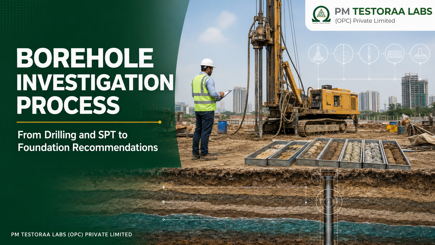
Borehole Investigation Process
A scientifically planned borehole investigation reveals the soil and rock conditions hidden below a project site. This guide explains every stage—from planning, drilling and SPT to sampling, laboratory testing, bearing-capacity evaluation and the final geotechnical report—in language useful to property owners, architects, builders and engineers.
What is a borehole investigation?
A borehole investigation is a controlled method of exploring the ground by drilling a relatively small-diameter hole and recording the materials encountered with depth. The investigation may include in-situ tests, collection of disturbed and relatively undisturbed samples, groundwater observations and rock coring where required. The information is presented as a borehole log and interpreted by a geotechnical engineer.
For a building owner, the easiest comparison is a medical scan. The ground surface shows only the “skin” of the site. A borehole allows the engineering team to examine the layers beneath it: loose fill, sand, silt, clay, gravel, weathered rock or competent rock. Each layer behaves differently under foundation load. Some layers drain quickly, some compress slowly, some swell or shrink with changes in moisture, and some lose strength when saturated.
The objective is not merely to reach a stated depth or collect soil in bags. The objective is to develop a reliable ground model that supports decisions about foundation type, founding level, allowable bearing pressure, settlement, excavation, groundwater, earth-retaining works and construction risks.
Key principle: A borehole is a source of evidence, not a foundation design by itself. The usefulness of the investigation depends on where the boreholes are located, how deep they extend, how accurately the strata and groundwater are logged, how representative the samples are, and how responsibly the results are interpreted.
Why is borehole investigation necessary before construction?
Two neighbouring plots can have different subsurface conditions even when their ground levels and surface appearance are similar. One plot may contain dense natural gravel near the surface, while the other may contain filled ground, soft clay, an old drainage channel or a deep weathered zone. Foundation decisions based only on nearby experience can therefore be misleading.
A properly scoped investigation reduces uncertainty. It does not make soil perfectly predictable, but it converts unknown conditions into measurable engineering information. This is especially important for multistorey buildings, industrial facilities, warehouses, hospitals, schools, tanks, machine foundations, retaining structures and sites with filled, sloping, expansive or waterlogged ground.
1
Safety and stability
Identifies weak or variable layers that may contribute to bearing failure, excessive settlement, differential movement or instability.
2
Economical foundations
Prevents both under-design and unnecessary over-design by matching the foundation system to the actual ground conditions.
3
Construction planning
Provides early information about groundwater, hard layers, boulders, unstable bore walls and likely excavation difficulties.
4
Documented decisions
Creates traceable bore logs, test records and recommendations for coordination between the owner, architect and structural engineer.
Skipping investigation may appear to save time at the beginning, but unexpected ground conditions discovered during excavation can cause redesign, delays, additional concrete, foundation deepening, dewatering, soil replacement or disputes. The cost of investigation is generally small compared with the value of the structure and the consequences of foundation distress.
Planning the borehole investigation
The investigation begins before the drilling rig reaches the site. The geotechnical professional should understand the proposed structure, column loads where available, basement depth, site dimensions, neighbouring structures, topography, drainage, previous land use and any known history of filling or excavation.
How many boreholes are required?
There is no responsible universal answer such as “one borehole for every house.” The number and spacing depend on the building footprint, structural importance, magnitude and distribution of loads, variability of the terrain, depth of influence, presence of slopes or retaining works, and the consequences of missing a weak zone. Boreholes should represent critical portions of the proposed structure rather than simply the easiest points for the rig to reach.
A single exploratory borehole may provide preliminary information for a small, lightly loaded structure on a uniform site, but it cannot establish lateral variation across a large or geologically variable plot. Additional boreholes or other exploration methods may become necessary when fill, soft pockets, abrupt strata changes, cavities, boulders or inconsistent test results are encountered.
How deep should the borehole go?
Borehole depth is not chosen only as 5 m, 10 m or 15 m from a price list. It should extend sufficiently below the proposed foundation level to investigate the zone in which foundation stresses are significant and to identify weak compressible layers that could affect settlement. The required depth depends on foundation width, load, proposed founding level, soil profile and whether a shallow or deep foundation is being considered.
Drilling may need to continue if weak strata persist, if competent material has not been established, or if the design changes. Encountering a hard layer does not automatically justify termination; it could be a thin gravel band, boulder or weathered crust over weaker material. Where rock is relevant, coring and rock-quality assessment may be specified.
Safety before drilling: The client and site team must identify underground electrical cables, water lines, sewer lines, gas lines, tanks and other utilities. Borehole locations should be cleared and authorised before the rig is set up. Never assume that an open area is free from buried services.
What should the client provide?
- Proposed building plan, footprint and available structural-load information.
- Clear access for the drilling rig, crew and equipment.
- Authorised and physically marked borehole locations.
- Information on known utilities, filled areas, old wells and underground structures.
- Site water and safe working space where the selected drilling method requires them.
- Permission for drilling, sampling and temporary disturbance of the ground surface.
Borehole investigation process: step by step
Plan and locate
Drill and log
Test and sample
Interpret and report
- Define the engineering objective. The investigator reviews the proposed construction, expected loads, foundation alternatives and specific risks. A residential building, industrial machine foundation and retaining wall do not require identical information.
- Complete desk study and site reconnaissance. Available drawings, nearby records, geology, site history, drainage, slopes, existing distress and access constraints are reviewed. Surface observations guide—but do not replace—subsurface exploration.
- Select and mark borehole locations. Points are chosen to represent the building footprint and areas of high load or suspected variability. Coordinates, offsets or a marked site plan should allow the locations to be reproduced.
- Mobilise and set up the drilling equipment. The rig is positioned on stable ground, verticality is checked, the work zone is barricaded and utilities are reconfirmed. The ground level at each borehole is recorded against an agreed datum where levels are important.
- Advance the borehole. An appropriate method—such as auger, shell-and-auger, rotary wash or rotary drilling—is selected for the soil, depth and sampling objectives. Casing or drilling fluid may be used to support unstable sides, but its use must not destroy the information being sought.
- Observe and log strata continuously. Changes in colour, particle size, plasticity, consistency, relative density, moisture, inclusions, fill, gravel, cobbles, weathering and drilling response are recorded at their observed depths.
- Conduct in-situ testing. The Standard Penetration Test is commonly performed at specified intervals and at significant stratum changes. Other tests may be selected when SPT alone cannot answer the design question.
- Collect representative samples. Disturbed samples are obtained for identification and classification. Relatively undisturbed samples may be taken from cohesive layers for strength, compressibility or density testing when sample quality and ground conditions permit.
- Record groundwater observations. Water entry during drilling, water level after a suitable waiting period and any fluctuation are documented. Drilling water and temporary casing can influence readings, so the observation method and time must be reported.
- Assess refusal, boulders or rock. High penetration resistance is investigated carefully. SPT refusal does not by itself prove continuous competent rock. Where necessary, rock coring is undertaken and core recovery, weathering, discontinuities and Rock Quality Designation are recorded.
- Seal or backfill the completed borehole. The hole is made safe and closed in a manner appropriate to the ground and environmental conditions. Open boreholes can create safety, contamination and settlement hazards.
- Test, analyse and report. Field data and laboratory results are checked together. The engineer develops the ground model, evaluates bearing and settlement behaviour, identifies limitations and issues foundation and construction recommendations.
Common drilling methods and why method selection matters
The drilling method affects borehole stability, sample quality, groundwater observation and the reliability of SPT results. No method is best for every site. The investigator chooses equipment based on soil type, required depth, access, groundwater and whether rock is expected.
| Method | Common application | Engineering considerations |
|---|---|---|
| Hand or power auger | Shallow exploration in cohesive or partly stable soils | Simple and useful for shallow work, but difficult below groundwater or in gravel, cobbles and collapsing sand. |
| Shell-and-auger / percussion methods | Many soil profiles where casing support is required | Can advance through varied deposits; careful cleaning and depth control are essential before testing and sampling. |
| Rotary wash boring | Deeper soil exploration with casing and circulating fluid | Efficient, but drilling fluid and wash return can complicate visual identification and groundwater readings. |
| Rotary drilling and rock coring | Weathered and competent rock investigation | Core barrel, bit, run length, recovery and handling influence the quality of rock information. |
Whatever the method, the borehole must be cleaned adequately before an in-situ test. Loose cuttings at the base can produce misleading resistance or contaminated samples. Bore diameter, casing level, drilling-fluid level and equipment condition should be controlled and documented.
Standard Penetration Test (SPT): what happens inside the borehole?
The SPT is one of the most widely used in-situ tests in Indian geotechnical practice. The current Bureau of Indian Standards listing is IS 2131:2025—Standard Penetration Test of Soil, Method of Test. The test provides penetration resistance and a disturbed sample that assists visual identification.
In general terms, a split-spoon sampler is lowered to the cleaned bottom of the borehole and driven using standardised equipment. The blows required for successive penetration increments are recorded. The initial penetration acts as seating, and the reported N-value is based on the specified subsequent penetration in accordance with the applicable procedure. Equipment, hammer operation, borehole condition and operator control all influence the result.
What does an N-value mean? It is a measured resistance to penetration at a specific depth under a defined test procedure. It is not directly a bearing-capacity value in kN/m² and it is not a substitute for soil classification, groundwater information, foundation geometry and settlement analysis.
How engineers use SPT information
- Comparing relative density trends in granular soils.
- Supporting consistency assessment in cohesive soils, with appropriate caution.
- Identifying weak, loose or variable zones.
- Supporting empirical correlations for strength, settlement and foundation assessment.
- Providing inputs for liquefaction-related evaluation when the full required methodology is followed.
- Comparing strata between boreholes and selecting additional investigation where results conflict.
Raw N, corrected N and N60
The field blow count may require corrections or normalisation depending on the engineering application. Energy delivered by the hammer system, rod length, borehole diameter, sampler arrangement and overburden stress can influence correlations. In saturated fine sand or silt, a dilatancy-related correction may also be relevant under applicable methods. The report should clearly distinguish observed values from corrected values and state the adopted procedure.
Blindly copying a correlation from a textbook without confirming its basis can produce false precision. Correlations developed for N60, for example, should not be applied to an uncorrected field value as though the two were identical.
SPT limitation: Gravel, cobbles, cemented layers and boulders may produce high resistance that is not representative of a continuous bearing stratum. Very soft soils can also be significantly disturbed by sampling. The engineer may specify complementary tests when SPT is unsuitable or insufficient.
Disturbed and undisturbed soil samples
Sampling is not simply collecting “some soil” from the borehole. The sample type must match the laboratory test and the engineering question. Every container should be labelled with project, borehole number, sample number, depth, date and sample type, and the chain of identification should continue into the laboratory.
| Sample type | Typical uses | Important limitations |
|---|---|---|
| Disturbed sample | Visual identification, grain-size distribution, Atterberg limits, specific gravity and chemical tests | Natural structure and stress condition are not preserved; generally unsuitable for reliable compressibility or intact-strength parameters. |
| SPT split-spoon sample | Stratum identification and selected classification testing | Driven sample is disturbed and may have limited recovery; coarse particles may not be represented reliably. |
| Bulk sample | Compaction, classification and selected earthwork-related tests | Does not preserve in-situ structure; adequate quantity and representative collection are essential. |
| Thin-walled tube sample | Density, unconfined compression, triaxial or consolidation testing of suitable cohesive soils | “Undisturbed” is relative. Sample quality depends on sampler geometry, pushing, recovery, sealing, transport and extrusion. |
| Rock core | Lithology, weathering, discontinuities, core recovery, RQD and strength testing where specified | Core loss and drilling-induced breaks must be distinguished from natural fractures as far as practicable. |
Relatively undisturbed samples require special care. Tube ends should be protected, sealed and kept in the correct orientation. Shock, vibration, moisture loss, temperature changes and careless extrusion can alter the result. A laboratory number cannot compensate for a poor-quality sample.
What information should a borehole log contain?
The borehole log is the primary factual record of the exploration. A clear log lets another engineer understand what was encountered, at what depth, how it was tested and what uncertainties remain. Logs should be prepared from field observations, not reconstructed later from memory.
- Project, location, borehole identification and coordinates or offsets.
- Existing ground level or agreed datum and drilling date.
- Drilling method, bore diameter, casing and drilling-fluid information.
- Depth boundaries and engineering description of each stratum.
- Colour, particle size, grading, plasticity, consistency or relative density.
- Fill, organic matter, roots, debris, calcareous matter, gravel, cobbles and other inclusions.
- Sample numbers, types, depths and recoveries.
- SPT blow counts, N-values and test depths.
- Groundwater observations with time and relevant drilling conditions.
- Rock core recovery, RQD, weathering and discontinuity information when coring is performed.
- Termination depth and reason for termination.
Soil classification
Field descriptions are refined using laboratory results. The Indian soil-classification system under IS 1498 considers particle-size distribution and plasticity characteristics. Symbols such as GW, SP, CL or CH summarise engineering groups, but the symbol should not replace a complete description. Two soils with the same group symbol may still differ in density, structure, mineralogy, groundwater condition and performance under load.
Common-man interpretation: The bore log is a vertical story of the ground. It shows what changes as we move downward, where tests and samples were taken, where water was seen, and why the engineer selected a particular founding depth.
Groundwater observation: a reading with conditions attached
Groundwater can reduce effective stress, influence bearing behaviour, increase excavation difficulty, create base heave or piping risks, increase lateral pressure and affect basement waterproofing. It may also carry chemicals that influence concrete durability. For these reasons, water observations are an essential part of borehole investigation.
A water level noted immediately during drilling may not represent the equilibrium groundwater table. Wash water can create an artificially high level, while casing, low-permeability clay or insufficient waiting time can delay stabilisation. The log should state when water was first encountered, when the level was measured and whether the borehole contained drilling fluid.
Groundwater is seasonal. A dry borehole on one investigation day does not guarantee dry excavation throughout the year. Monsoon conditions, nearby wells, leaking utilities, irrigation and site grading can change the water regime. Important projects may require standpipes or piezometers and repeat monitoring.
Laboratory tests after borehole drilling
The laboratory programme should be selected from the soil profile and design requirements rather than applying every available test to every sample. Identification tests build the ground model; strength and compressibility tests support design; chemical tests inform durability. Representative samples and proper preparation are essential.
| Test | What it helps determine | Typical application |
|---|---|---|
| Natural moisture content | Water present relative to dry soil mass | Interpreting consistency, saturation and sample condition. |
| Specific gravity | Relative density of soil solids | Phase relationships and classification calculations. |
| Grain-size analysis | Proportions of gravel, sand, silt and clay-size fraction | Classification, drainage behaviour and material assessment. |
| Liquid and plastic limits | Plasticity and consistency limits of fine-grained soil | IS classification, compressibility and volume-change indications. |
| Bulk and dry density | Mass-volume relationship | Unit weight, overburden and settlement-related interpretation. |
| Unconfined compression | Undrained strength of suitable cohesive specimens | Short-term strength assessment where sample quality permits. |
| Direct shear or triaxial testing | Shear-strength parameters under specified drainage and stress conditions | Bearing capacity, stability and retaining-structure assessment. |
| Consolidation testing | Compressibility and rate of settlement | Fine-grained compressible strata and settlement-sensitive projects. |
| Permeability | Rate of water flow through soil | Dewatering, drainage, seepage and earthwork evaluation. |
| pH, sulphate and chloride | Chemical exposure indicators | Concrete durability and material-selection considerations. |
The IS 2720 series contains methods for soil testing, including sample preparation, moisture content, specific gravity, grain-size analysis, consistency limits, strength and other properties. The report should identify the methods actually used and should not list a test merely because it appears in a standard package.
From borehole data to safe foundation recommendations
The most important work begins after the field and laboratory data are assembled. The geotechnical engineer reconciles bore logs, SPT resistance, samples, laboratory results, groundwater and the proposed structural loading. Contradictions are investigated instead of being averaged away.
Developing the ground model
The first step is to identify the likely sequence, thickness and lateral variation of strata. Boreholes are discrete points; the lines drawn between them are interpretations. Where changes are abrupt or the consequence of uncertainty is high, additional investigation may be required.
Bearing capacity and allowable pressure
Bearing capacity addresses the risk of shear failure beneath a foundation. The Indian reference commonly used for shallow-foundation bearing capacity is IS 6403. Calculations require more than an SPT number: foundation width and depth, soil unit weight, shear parameters, groundwater, load inclination, shape and other conditions may be relevant.
The terms ultimate, safe, gross, net and allowable bearing pressure should not be used interchangeably. In practice, the recommended allowable value is often controlled by settlement rather than shear. It must also correspond to an assumed foundation type, size, founding depth and loading condition.
Settlement assessment
A foundation can remain safe against shear failure yet settle enough to crack walls, tilt floors, disturb services or misalign equipment. Settlement assessment considers compressibility, stress increase, layer thickness, drainage, foundation geometry and time. Differential settlement between columns or building blocks can be more damaging than uniform settlement.
Foundation recommendation
The report may recommend isolated footings, combined footings, strip footings, raft foundation, ground improvement or deep foundations depending on the evidence and structural requirements. It should state founding depth, allowable pressure or design parameters, groundwater considerations, excavation precautions, replacement of loose fill, blinding, drainage and verification requirements.
Engineering coordination: The geotechnical report provides ground parameters and recommendations. The structural engineer uses them with actual column loads, foundation geometry and code requirements to complete the foundation design. If loads or layout change significantly, the geotechnical recommendations should be reviewed.
A simple hypothetical example
Suppose a proposed G+2 building has loose fill in the upper layer, medium-dense soil below and a denser stratum at greater depth. The SPT resistance increases with depth, but groundwater is observed near the proposed excavation level. A good report would not merely state the highest N-value. It would consider removal or bypassing of uncontrolled fill, suitable founding level, groundwater effect, settlement, excavation stability and whether the available boreholes adequately represent the footprint.
If another borehole shows soft clay where the first showed dense gravel, the investigation has revealed lateral variability. The correct response may be additional exploration or a foundation system that accommodates the variation—not selecting whichever result gives the cheaper foundation.
Common mistakes in borehole investigation
1
Choosing only convenient locations
Easy rig access should not override the need to represent critical loads and suspected ground variation.
2
Stopping at the first hard layer
A boulder, thin crust or gravel band may be mistaken for continuous competent stratum without verification.
3
Poor borehole cleaning
Cuttings at the test level can distort SPT resistance and contaminate recovered material.
4
Incomplete sample labels
A sample without reliable borehole and depth identity loses much of its engineering value.
5
Treating N as SBC
Converting a blow count directly into one universal bearing value ignores foundation and groundwater conditions.
6
Ignoring settlement
Shear safety alone does not ensure acceptable building performance.
7
Unqualified groundwater statement
A single immediate observation may be affected by drilling water, casing and insufficient stabilisation time.
8
Copy-paste recommendations
Foundation advice must match the project load, bore logs, tests and actual site conditions.
Quality controls that improve investigation reliability
- Use a project-specific investigation plan and maintain approved borehole-location records.
- Check drilling equipment, sampler condition, rods and hammer system before work.
- Record observations at the time of drilling with depth control.
- Clean the borehole before testing and sampling.
- Protect samples from moisture loss, impact and misidentification.
- Use calibrated laboratory equipment and applicable test procedures.
- Review field and laboratory data together for inconsistencies.
- Separate factual records from engineering interpretation in the report.
- State limitations, assumptions and the need for additional investigation where applicable.
- Arrange foundation-level verification during construction, especially where variable ground or fill is expected.
Quality is not demonstrated by the number of pages in a report. It is demonstrated by traceable observations, representative exploration, suitable tests, transparent calculations and recommendations that can be followed at site.
What should a professional geotechnical report deliver?
A useful report should enable the project team to make and verify foundation decisions. Typical deliverables include:
- Project description, investigation scope and site plan with borehole locations.
- Field methodology, dates, equipment and applicable standards.
- Individual borehole logs and interpreted soil stratification.
- SPT observations and clearly identified corrected values where used.
- Sample schedule and laboratory test results.
- Groundwater observations with timing and limitations.
- Engineering classification and design parameters.
- Bearing-capacity and settlement evaluation appropriate to the scope.
- Foundation type, founding depth and allowable-pressure recommendations.
- Excavation, fill removal, dewatering, drainage and construction precautions.
- Limitations, assumptions and conditions requiring geotechnical review.
Before construction: The foundation designer should confirm that the proposed loads and footing sizes remain within the basis of the geotechnical recommendations. During excavation, the exposed founding stratum should be compared with the report. Unexpected fill, soft pockets, seepage or different strata should be referred back to the geotechnical and structural professionals.
Frequently asked questions
Is a borehole investigation the same as a soil test?
No. Borehole investigation is the broader field exploration process involving drilling, logging, in-situ testing, sampling and groundwater observation. Laboratory soil tests are performed on selected samples obtained during that investigation.
How many boreholes are needed for a building?
The number depends on footprint, loads, structural importance and ground variability. One borehole may provide limited preliminary information for a small uniform site, but larger or variable sites generally require multiple locations. The geotechnical professional should define the scope.
What depth should be drilled?
The borehole should investigate the significant foundation-stress zone and any deeper weak compressible strata. Required depth depends on load, foundation dimensions, founding level, soil profile and foundation type; it should not be selected only from a standard commercial package.
What is the SPT N-value?
It is penetration resistance measured at a particular depth using a standardised test procedure. Engineers use it with soil type, groundwater, equipment corrections and project conditions. It is not itself an SBC value.
Does a high N-value always mean rock?
No. Gravel, cobbles, cemented soil or a boulder can give very high resistance. Rock should be confirmed by appropriate drilling, coring and geological description when it is important to the design.
Why are disturbed and undisturbed samples both collected?
Disturbed samples are useful for identification and classification. Relatively undisturbed samples are required for tests where natural structure and density matter, such as strength or consolidation testing of suitable cohesive soils.
Can groundwater level change after the investigation?
Yes. It can vary with season, rainfall, nearby pumping, irrigation, drainage and leakage. A single borehole observation represents the conditions and measurement procedure at that time.
How long does the process take?
Duration depends on number and depth of boreholes, site access, soil or rock conditions, testing programme and reporting scope. Routine field work may be completed within a few working days, while laboratory testing and engineering interpretation require additional time.
Can the foundation be designed before the report is issued?
Preliminary planning can continue, but final foundation decisions should use the reviewed geotechnical results and actual structural loads. Designing first and testing later can lead to costly changes.
What if excavation reveals soil different from the borehole log?
Stop treating the report as a fixed prediction and seek review. Boreholes are point observations, and unexpected variation should be assessed before concreting the foundation.
Is one report permanently valid for any future building on the plot?
No. Recommendations correspond to the investigated locations, proposed structure, loads and site conditions. A different building, deeper basement, changed ground level, major filling or long time gap may require review or additional investigation.
Key Indian Standards relevant to borehole investigation
| Standard | Relevance |
|---|---|
| IS 1892:2021 | Subsurface investigation for foundations—Code of practice, second revision. |
| IS 2131:2025 | Standard Penetration Test of Soil—Method of Test. |
| IS 2132:1986 | Thin-walled tube sampling of soils. |
| IS 1498:1970 | Classification and identification of soils for general engineering purposes. |
| IS 2720 series | Methods of test for soils, including moisture, specific gravity, grain size, consistency limits and strength tests. |
| IS 6403:1981 | Determination of bearing capacity of shallow foundations. |
| IS 8009 (Part 1):1976 | Calculation of settlement of shallow foundations under the stated scope. |
| IS 1904:2021 | General foundation-related requirements applicable to design and construction. |
Standards should be used in their current applicable form with amendments and project-specific requirements. The presence of a standard number in a report does not prove compliance; field procedure, records, equipment, sample quality, calculations and professional interpretation must also be demonstrable.
Why choose PM Testoraa Labs?
PM Testoraa Labs (OPC) Private Limited approaches geotechnical investigation as an engineering decision process—not merely drilling to a quoted depth. Our scope integrates borehole exploration, SPT, representative sampling, soil stratification, groundwater observation, laboratory testing, bearing-capacity and settlement considerations, and practical foundation recommendations.
Structured field records
Clear borehole identification, depth-wise strata observations, SPT data, sample tracking and groundwater notes.
Laboratory integration
Selection of relevant classification, strength, density and chemical tests based on the recovered soil profile.
Engineering interpretation
Ground data interpreted for foundation behaviour, construction risks and project-specific decisions.
Transparent reporting
Assumptions, limitations and recommendations communicated clearly to owners, architects and structural engineers.
Technical references
- Bureau of Indian Standards, IS 1892:2021—Subsurface investigation for foundations.
- Bureau of Indian Standards, IS 2131:2025—Standard Penetration Test of Soil.
- Bureau of Indian Standards, IS 1498:1970—Classification and identification of soils.
- Bureau of Indian Standards, IS 6403:1981—Bearing capacity of shallow foundations.
- Bureau of Indian Standards, IS 2720 series—Methods of test for soils.
- Bureau of Indian Standards, IS 2132:1986—Thin-walled tube sampling of soils.
- Bureau of Indian Standards, IS 8009 (Part 1):1976—Settlement of shallow foundations.
- Relevant project drawings, structural-load information and site-specific investigation records.
Planning a building or industrial project?
Begin with evidence below the ground. Contact Testoraa Labs for borehole investigation, SPT, soil sampling, laboratory testing, SBC evaluation and geotechnical foundation recommendations in Coimbatore and across project locations.
Call +91 97870 59595Request a Geotechnical InvestigationProfessional note: This article is intended for technical awareness and does not constitute a site-specific geotechnical report or foundation design. Borehole number, depth, testing, design parameters and recommendations must be established by qualified professionals for the proposed structure and actual site. Additional exploration may be required where the ground is variable or the available investigation is limited.